

A GPS tracking solution gives fleet managers continuous visibility into vehicle locations, routes, driver activity, and asset utilization. However, modern fleet tracking involves much more than placing dots on a digital map. The right platform can help a business reduce fuel consumption, improve delivery performance, protect valuable assets, monitor driver safety, and simplify fleet administration.
Choosing the best system requires a clear understanding of your operational requirements. A small local delivery company may need straightforward vehicle tracking and geofencing. At the same time, a nationwide trucking fleet may require ELD integration, maintenance reporting, route optimization, fuel analytics, dashcams, and application programming interface access.
This guide explains how to compare GPS fleet tracking solutions and select a platform that supports both your current operations and future growth.
What Is a Fleet GPS Tracking Solution?
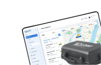
A fleet GPS tracking solution combines in-vehicle or asset-mounted tracking devices with cloud-based fleet management software. GPS devices determine the location of vehicles or equipment and transmit that information to a centralized platform.
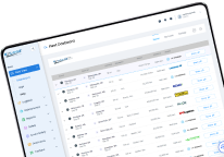
Fleet managers can then use a desktop dashboard or mobile application to monitor:
- Current vehicle locations;
- Routes and trip history;
- Vehicle speed and direction;
- Arrival and departure times;
- Driver behavior;
- Vehicle utilization;
- Idle time;
- Geofence activity;
- Maintenance requirements;
- Operational exceptions.
The most advanced platforms combine GPS data with telematics, vehicle diagnostics, driver records, safety tools, and reporting features. This turns basic location information into actionable operational insights.
How GPS Fleet Tracking Works
A GPS device receives positioning information from navigation satellites. The device calculates its location and transmits the resulting data through a cellular or another supported communication network.
The fleet management platform processes this information and displays it on a digital map. Depending on the device and subscription plan, the system may also receive vehicle speed, ignition status, engine diagnostics, fuel information, mileage, and driver activity.
Fleet managers can use the platform to monitor live operations, investigate previous trips, configure alerts, and produce reports.
GPS Tracking vs. Fleet Management Software
Basic GPS tracking answers one primary question: where is the vehicle?
Fleet management software provides a broader operational picture. It can help managers understand:
- Whether the vehicle is following its assigned route;
- How efficiently the vehicle is being used;
- Whether the driver is speeding or idling excessively;
- When the vehicle requires maintenance;
- How much fuel is being consumed;
- Whether an asset has entered or left a designated area;
- Whether a driver is complying with applicable operational requirements.
For fleets that require more than location monitoring, an integrated fleet management platform usually provides greater long-term value than a standalone tracker.
Start by Identifying Your Fleet’s Requirements
Before comparing providers, document the problems the new system must solve. Without clearly defined objectives, companies may purchase unnecessary features or select a system that cannot address their most important operational challenges.
Consider Fleet Size and Vehicle Types
The appropriate tracking system depends partly on what the business operates. A mixed fleet may include:
- Heavy-duty commercial trucks;
- Light commercial vehicles;
- Passenger buses;
- School buses;
- Construction machinery;
- Agricultural equipment;
- Trailers and containers;
- Non-powered assets;
- Service and delivery vehicles.
Different assets may require different installation methods, reporting intervals, battery capacities, and environmental protection levels. A tracker designed for a passenger vehicle may not be suitable for a trailer, heavy truck, or piece of construction equipment.
Define the Operational Problems
Common reasons for implementing GPS fleet tracking include:
- Excessive fuel expenses;
- Inefficient routing;
- Unauthorized vehicle use;
- Vehicle or cargo theft;
- Delivery delays;
- Limited dispatcher visibility;
- Excessive idling;
- Unsafe driving behavior;
- Unplanned maintenance;
- Poor vehicle utilization;
- Incomplete operational records;
- Difficulty providing accurate arrival estimates.
Prioritize these problems according to their financial and operational impact. This creates a practical framework for comparing potential solutions.
Establish Measurable Objectives
Each requirement should be connected to a measurable result. For example, a company may want to:
- Reduce average idle time;
- Decrease unnecessary mileage;
- Improve on-time delivery rates;
- Lower fuel consumption per vehicle;
- Reduce speeding events;
- Increase asset utilization;
- Decrease unplanned downtime;
- Improve dispatcher response times.
These objectives can later be used to evaluate the effectiveness of a pilot program and calculate return on investment.
Essential Features to Look for
The best solution is not necessarily the one with the longest feature list. It is the platform that provides reliable capabilities corresponding to your fleet’s actual needs.
Real-Time Vehicle and Asset Tracking
Real-time tracking should provide an accurate and regularly updated view of each connected vehicle or asset. Managers should be able to see its location, direction, speed, status, and recent activity.
When comparing systems, ask:
- How frequently is location data updated?
- Can the update interval be configured?
- Is historical location data available?
- How long is trip history retained?
- Can vehicles and assets be organized into groups?
- Can several users monitor the fleet simultaneously?
Frequent updates may be especially important for time-sensitive deliveries, emergency services, high-value cargo, and large dispatch operations.
Geofencing and Automated Alerts
A geofence is a virtual boundary placed around a geographical area. The system generates an event when a tracked vehicle enters or leaves that area.
Geofencing can be used to monitor:
- Customer locations;
- Warehouses and terminals;
- Construction sites;
- Restricted areas;
- Driver service regions;
- Vehicle storage facilities;
- Delivery and loading zones.
Alerts may also be configured for speeding, prolonged idling, unauthorized movement, route deviations, device disconnection, or movement outside permitted hours.
Effective notifications should be customizable. Fleet managers should be able to determine who receives an alert, what event triggers it, and whether it is delivered through the platform, email, text message, or mobile notification.
Route Planning and Optimization
Route optimization can reduce unnecessary mileage, improve delivery times, and help dispatchers react to changing conditions.
A suitable platform should make it easier to:
- Plan efficient routes;
- Compare planned and completed trips;
- Identify repeated route deviations;
- Monitor arrival and departure times;
- Reroute vehicles when necessary;
- Provide more accurate estimated arrival times;
- Analyze mileage and travel duration.
The value of route optimization increases with the number of vehicles, delivery points, and daily assignments managed by the fleet.
Driver Behavior Monitoring
Driver behavior directly affects safety, fuel consumption, vehicle wear, insurance exposure, and customer perception.
A GPS fleet management system may monitor:
- Speeding;
- Harsh braking;
- Rapid acceleration;
- Excessive idling;
- Sharp cornering;
- Unauthorized trips;
- Out-of-hours vehicle use.
These records should support fair and constructive driver coaching. Managers should analyze patterns over time instead of relying on isolated incidents without context.
When combined with dashcam footage, telematics data can provide a more complete understanding of safety events.
Fuel Monitoring
Fuel is one of the largest operating expenses for many commercial fleets. A tracking platform can help identify behaviors and operating conditions that contribute to unnecessary fuel use.
Relevant information may include:
- Idle time;
- Excessive mileage;
- Inefficient routes;
- Speeding;
- Aggressive acceleration;
- Unauthorized trips;
- Fuel purchases;
- Differences between expected and actual consumption.
GPS data alone may not provide complete fuel information. Confirm whether the platform integrates with vehicle data, fuel cards, or a dedicated fueling management system.
Maintenance and Vehicle Diagnostics
A fleet tracking platform should help prevent avoidable breakdowns rather than merely record where they occurred.
Depending on the hardware and vehicle connection, maintenance tools may include:
- Mileage-based service reminders;
- Engine-hour tracking;
- Diagnostic trouble codes;
- Battery alerts;
- Inspection records;
- Scheduled maintenance notifications;
- Service history;
- Daily Vehicle Inspection Reports.
Automated reminders allow managers to schedule maintenance before minor issues develop into expensive repairs or operational disruptions.
Reporting and Analytics
Raw data is useful only when managers can convert it into practical information. Reports should be easy to configure, filter, export, and distribute.
Common fleet reports include:
- Trip and route history;
- Vehicle utilization;
- Driver performance;
- Idle time;
- Speeding events;
- Fuel consumption;
- Mileage;
- Geofence activity;
- Maintenance status;
- Arrival and departure times;
- Unauthorized vehicle use.
Look for scheduled reporting, customizable date ranges, export options, and dashboards that allow managers to identify trends without manually processing large datasets.
Mobile Access
Fleet managers and business owners do not always work from a central office. A mobile application should provide access to critical information without requiring a desktop computer.
Mobile functionality may include:
- Live vehicle locations;
- Driver and vehicle status;
- Alerts and notifications;
- Trip history;
- Basic reports;
- Route information;
- Communication with drivers or dispatchers.
The mobile interface should remain understandable even when hundreds of vehicles or assets are connected.
Evaluate the Tracking Hardware
Software performance depends on the quality and suitability of the installed hardware. A visually impressive platform cannot compensate for unreliable devices, poor installation, or insufficient connectivity.
Plug-and-Play vs. Hardwired Devices
Plug-and-play devices are generally faster to install and easier to transfer between vehicles. However, they may be disconnected intentionally or accidentally.
Hardwired devices provide a more permanent installation and may be more suitable for long-term commercial use. Installation can require additional labor and qualified technical assistance.
Battery-powered trackers are commonly used for trailers, containers, equipment, and other assets without a permanent power source.
Durability
Commercial tracking devices may be exposed to rain, dust, vibration, temperature changes, and physical impact. Review the device’s ingress protection rating and operating temperature range.
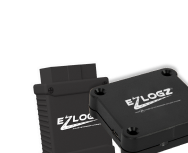
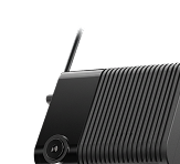
Hardware used on external assets should be designed for demanding operating conditions. The EZLOGZ GPS and Asset Tracking solution, for example, highlights IP68 protection, strong battery endurance, high-precision tracking, onboard speed and heading data, and a smart sleep mode.
Battery Life
Battery life is particularly important for non-powered assets. However, advertised battery duration should be evaluated in context.
Actual performance may depend on:
- Location update frequency;
- Environmental temperature;
- Cellular coverage;
- Device movement;
- Sleep-mode configuration;
- Battery age;
- Reporting volume.
Ask the provider how the device performs under operating conditions similar to your own.
Connectivity and Coverage
GPS determines the position, but the device still needs a communication network to transmit that position to the fleet platform.
Confirm that the provider offers suitable coverage across your operating territory. Companies working in rural or remote areas should ask how devices store and transmit information when cellular connectivity is temporarily unavailable.
Review Software Usability
A system may offer extensive functionality but still fail if dispatchers, drivers, and managers cannot use it efficiently.
Request a demonstration using scenarios relevant to your business. Ask the provider to show how a user would:
- Locate a specific vehicle;
- Review its completed route;
- Create a geofence;
- Configure a speeding alert;
- Generate an idle-time report;
- Identify a vehicle requiring maintenance;
- Add a new user;
- Export operational data.
The interface should require minimal training for common tasks. Important information should be visible without navigating through multiple unnecessary screens.
Consider Integrations
A standalone GPS platform can create additional administrative work when employees must transfer information manually between different systems.
Integration with existing tools can improve data accuracy and operational efficiency.
Important integrations may include:
- Electronic Logging Devices;
- Hours-of-Service records;
- Dash cameras;
- Fuel management systems;
- Maintenance platforms;
- DVIR tools;
- Dispatch systems;
- Load boards;
- Payroll and accounting software;
- ERP and CRM platforms;
- Customer communication tools.
For fleets with specialized software, API access may be essential. Review the provider’s documentation and determine whether the API supports the required data, update frequency, authentication method, and usage volume.
EZLOGZ positions GPS and asset tracking as part of a wider fleet management environment that includes ELD, dashcams, DVIR, fuel management, reporting, and API integration. An integrated ecosystem can reduce fragmented workflows when several fleet functions must work together. Explore EZLOGZ fleet management solutions.
Examine Data Security and Privacy
GPS systems collect sensitive information about vehicles, drivers, routes, customers, and operating locations. Security should therefore be treated as a central selection criterion.
Ask each provider:
- How is data protected during transmission and storage?
- Does the platform support individual user accounts?
- Can administrators assign role-based permissions?
- Is multi-factor authentication available?
- How frequently is data backed up?
- Where is customer data stored?
- How long is historical information retained?
- Who owns the collected data?
- What happens to the data when the contract ends?
- How are security incidents handled?
Internal access should also be controlled. Drivers, dispatchers, supervisors, and company administrators may require different levels of information.
Assess Scalability
A platform suitable for 10 vehicles may become difficult to manage when the fleet grows to 100 or 1,000 vehicles.
Evaluate whether the system can support:
- Additional vehicles and assets;
- Multiple terminals;
- Different business divisions;
- New geographical regions;
- Several user roles;
- Mixed vehicle categories;
- Customized reports;
- New integrations;
- Large volumes of historical data.
Scalability involves more than technical capacity. The provider should also be able to support larger deployments, more complex installations, additional training, and changing operational requirements.
Compare Support and Onboarding
Successful implementation depends on the quality of technical support and user onboarding.
Before signing a contract, determine whether the provider offers:
- Hardware installation guidance;
- Initial account configuration;
- Driver and dispatcher training;
- Documentation and training videos;
- Data import assistance;
- Technical support during operating hours;
- Emergency support;
- Dedicated account management;
- Device replacement procedures;
- Ongoing performance reviews.
Ask how support is delivered and whether assistance is included in the subscription price.
Understand the Total Cost
The cheapest advertised subscription does not always produce the lowest total cost. Calculate all direct and indirect expenses over the expected contract period.
Potential costs include:
- GPS devices;
- Device activation;
- Professional installation;
- Monthly software subscriptions;
- Cellular connectivity;
- Premium reports;
- Data storage;
- API access;
- Additional users;
- Training;
- Hardware replacement;
- Early contract termination.
Pricing should also be compared against the functionality included in each plan. A lower monthly fee may exclude features that are essential for your operation.
Calculate the Potential Return on Investment
A GPS tracking system should produce measurable operational value.
Potential sources of return include:
Lower Fuel Consumption
Better routing, reduced idling, and improved driving behavior can decrease avoidable fuel usage.
Reduced Mileage
Dispatchers can assign closer vehicles, eliminate inefficient journeys, and compare planned routes with completed trips.
Lower Maintenance Costs
Mileage, engine-hour, and diagnostic information can support preventive maintenance and reduce the likelihood of unexpected breakdowns.
Improved Productivity
Accurate vehicle visibility helps dispatchers make faster decisions and reduces time spent calling drivers for location updates.
Better Asset Utilization
Utilization reports can identify vehicles or equipment that are underused, overused, or assigned inefficiently.
Improved Customer Service
Live location information and more accurate arrival estimates allow companies to provide clearer customer updates.
Reduced Risk
Geofencing, unauthorized-use alerts, and live location data can support theft prevention and asset recovery.
To estimate ROI, compare the complete annual cost of the system with realistic savings in fuel, labor, maintenance, downtime, asset loss, and administrative work.
Questions to Ask a GPS Tracking Provider
Use the following questions during demonstrations and vendor comparisons:
- How frequently is vehicle location updated?
- Can the update interval be customized?
- Does the system track powered and non-powered assets?
- What happens when a vehicle loses cellular coverage?
- How long is historical data retained?
- Can alerts and geofences be customized?
- Which reports are included in the standard plan?
- Does the platform integrate with our ELD and other software?
- Is API access available?
- What hardware options are offered?
- Is professional installation required?
- How is customer data protected?
- Can the solution support future fleet growth?
- What training and technical support are included?
- What is the complete cost per vehicle or asset?
Common Selection Mistakes
Choosing Based Only on Price
Price matters, but an inexpensive system that lacks required functionality may create more work than it eliminates.
Ignoring Hardware Quality
Low-quality or unsuitable hardware can produce gaps in tracking data, inaccurate reports, and frequent maintenance requirements.
Purchasing Unnecessary Features
More features do not automatically create more value. Focus first on capabilities connected to specific operational objectives.
Overlooking Integrations
A disconnected platform may require manual data entry and prevent the business from gaining a complete view of fleet performance.
Excluding Drivers and Dispatchers
Managers, dispatchers, drivers, maintenance teams, and administrators use tracking information differently. Their input can reveal practical requirements that may not be visible to senior management.
Skipping a Pilot Program
A controlled pilot helps determine how the system performs under real operating conditions before a fleet-wide deployment.
Ignoring Scalability
Replacing an entire platform after a period of growth can be expensive and disruptive. Consider likely fleet requirements over the next several years.
How to Test a Solution Before Purchasing
A pilot program should involve a representative selection of vehicles, drivers, routes, and operating conditions.
Begin by recording baseline metrics such as:
- Average fuel consumption;
- Idle time;
- Mileage per assignment;
- On-time delivery rate;
- Speeding events;
- Maintenance downtime;
- Dispatcher response time.
Install the system on several vehicles and test it for a sufficient period. Confirm location accuracy, alert delivery, reporting quality, mobile access, hardware reliability, and user experience.
At the end of the pilot, compare the results with the baseline. Collect structured feedback from managers, dispatchers, drivers, and technicians before making the final decision.
Why Consider EZLOGZ?
EZLOGZ provides commercial GPS tracking capabilities designed to give fleet managers greater visibility into vehicles and assets. Its platform includes real-time tracking, geofencing, route information, driver monitoring, operational alerts, and reporting tools.
The solution is positioned as part of a broader fleet management ecosystem rather than as an isolated GPS product. Businesses can connect tracking with fleet-management functions such as ELD compliance, asset monitoring, safety tools, dashcams, fuel management, and reporting.
EZLOGZ also supports real-time data access for monitoring vehicle locations, routes, speed, mileage, fuel-related information, and other operational metrics. These capabilities help fleet managers identify inefficient processes and make decisions using consolidated fleet information. Learn more about EZLOGZ commercial GPS tracking.
The EZLOGZ real-time fleet tracking system is designed for fleets seeking to improve operational visibility, driver safety, route efficiency, maintenance planning, and cost control.
Final GPS Tracking Selection Checklist
| Evaluation criterion | What to verify |
| Real-time tracking | Accuracy, update intervals and trip history |
| Geofencing | Custom zones, entry and exit alerts |
| Driver monitoring | Speeding, braking, acceleration and idling |
| Route management | Planning, deviations, mileage and ETAs |
| Asset tracking | Support for trailers and non-powered equipment |
| Hardware | Durability, battery life and installation method |
| Maintenance | Service reminders, diagnostics and inspections |
| Reporting | Custom reports, scheduling and data export |
| Mobile access | Live map, alerts and operational information |
| Integrations | ELD, dashcams, fuel, DVIR, ERP and API |
| Security | Encryption, permissions and data retention |
| Scalability | Vehicles, users, terminals and asset categories |
| Support | Onboarding, training and technical assistance |
| Pricing | Hardware, installation, subscription and extra fees |
| ROI | Fuel, maintenance, labor and productivity savings |
The best GPS tracking solution is one that addresses clearly defined fleet-management requirements and produces measurable operational improvements. Location accuracy is important, but it should be considered alongside hardware reliability, geofencing, driver monitoring, route optimization, reporting, integrations, security, scalability, and customer support.
Before committing to a provider, define your objectives, compare the total cost, request a practical demonstration, and conduct a pilot using real vehicles and routes. This process reduces implementation risks and ensures that the selected platform can support both immediate priorities and long-term fleet growth.
Businesses looking for an integrated approach can consider EZLOGZ for real-time vehicle visibility, asset tracking, operational analytics, and connected fleet management tools.
FAQ:
What is the best GPS tracking solution for a commercial fleet?
The best solution is the one that matches the fleet’s operational requirements, vehicle types, geographical coverage, integration needs, and budget. It should provide reliable tracking, appropriate hardware, useful reports, scalable software, and responsive technical support.
How much does a fleet GPS tracking system cost?
Costs depend on the hardware, installation method, number of vehicles, update frequency, included features, integrations, and contract terms. Compare the complete cost rather than only the advertised monthly subscription.
How frequently should vehicle locations be updated?
The appropriate frequency depends on the operation. Time-sensitive delivery and dispatch fleets may require frequent updates, while long-term asset monitoring may prioritize battery life over second-by-second tracking.
Can GPS tracking reduce fuel costs?
GPS tracking can help identify excessive idling, speeding, unauthorized trips, unnecessary mileage, and inefficient routes. Managers can use this information to improve driver behavior and reduce avoidable fuel consumption.
What is the difference between GPS tracking and telematics?
GPS tracking primarily provides location information. Telematics combines location data with additional vehicle and operational information, such as speed, engine status, diagnostics, driving behavior, and fuel-related metrics.
Can GPS systems track trailers and equipment?
Yes. Battery-powered and ruggedized devices can be used to monitor trailers, containers, machinery, and other non-powered assets. Battery endurance, environmental protection, connectivity, and update frequency should be evaluated carefully.
Does GPS tracking integrate with ELD systems?
Many fleet management platforms support ELD integration. An integrated system can combine vehicle location with Hours-of-Service and driver records, but the exact functionality should be confirmed with the provider.
How does geofencing improve fleet security?
Geofencing allows managers to create virtual boundaries and receive notifications when an asset enters or leaves a designated area. It can help identify unauthorized movement, route deviations, and unusual out-of-hours activity.
Can GPS tracking improve driver safety?
GPS and telematics data can identify patterns such as speeding, harsh braking, rapid acceleration, and excessive idling. Managers can use these insights for targeted coaching and safety improvement programs.
How long does GPS installation take?
Installation time depends on the device. Plug-and-play units can often be installed quickly, while hardwired systems may require professional installation. Large or mixed fleets should request a detailed deployment schedule from the provider.